Coastal Charts & Maps
Physical Store1709, West Lemon Street, Tampa, 33606, FL, US
Location
Is this your store? Claim this listing to update your info, add photos, and reach more customers.
Products (41)
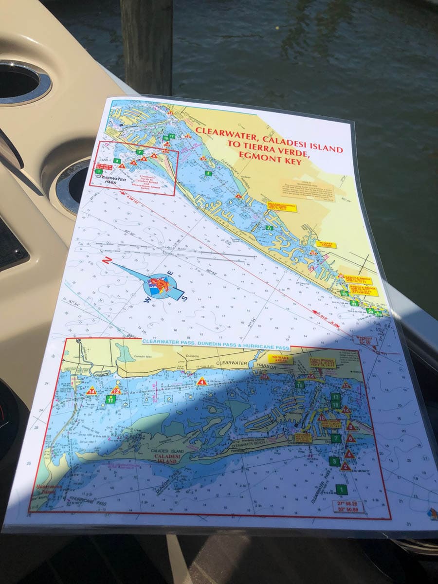
Clearwater, Caladesi Island to Tierra Verde, Egmont Key Nautical Chart
$26.00
Clearwater, Florida north to Dunedin, Florida and Caladesi Island and south to Shell Island and Egmont Key. Waypoints are included along with approximate mileage from pass to pass. Bridge horizontal and vertical clearances as well as no wake areas. Enlarged navigation markers along with photographic visuals. The chart measures 11″ x 17″ closed and 22″ x 17″ open. Full lamination at 10 mil. “Write-On Wipe-Off! Time after Time” with a Sharpie marker and alcohol. Used by Coast Guard and Coast Guard Auxilliaries, Marinas, Boat Rentals, Boat Clubs, County Sheriffs, Insurance companies, Real Estate and more! Easiest Boating Chart You Will Ever Use
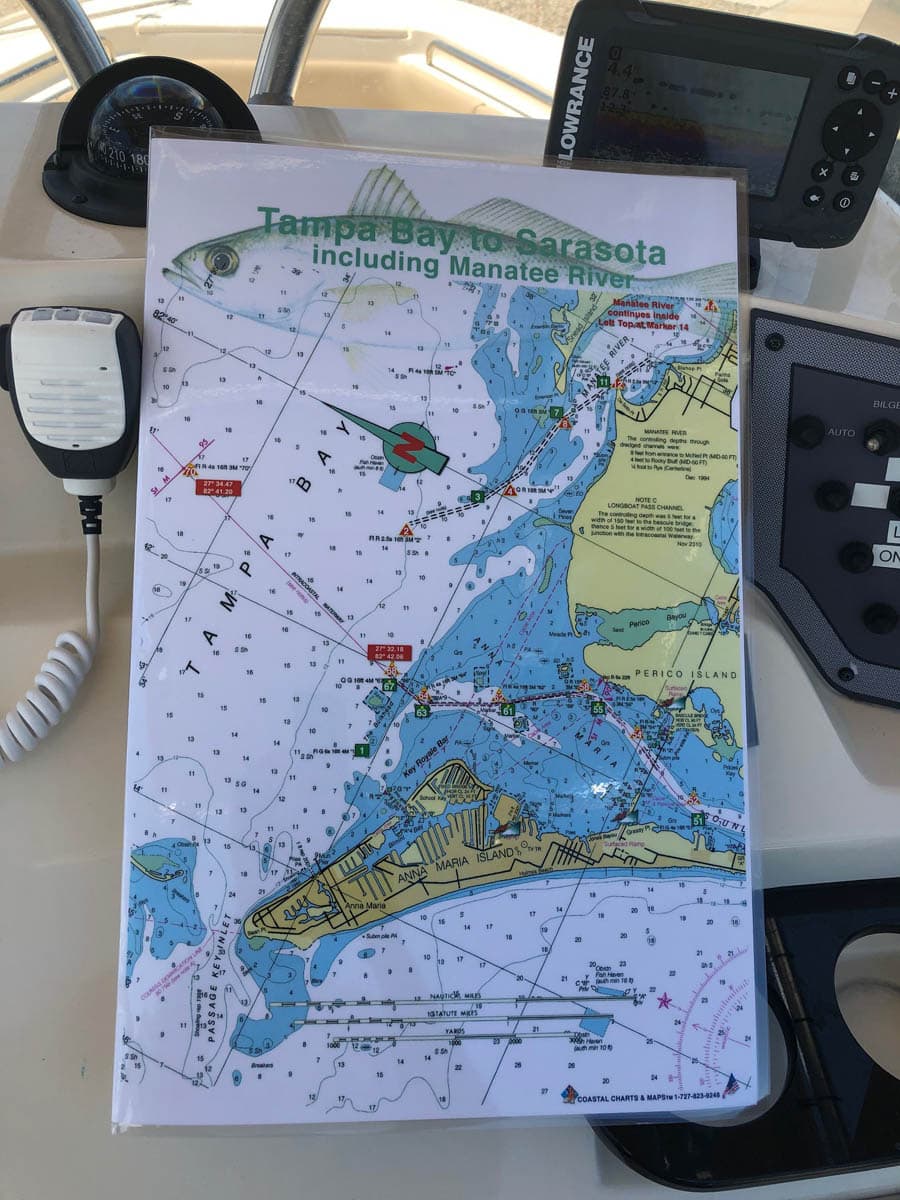
Tampa Bay to Sarasota including the Manatee River Nautical Chart
$26.00
Enlarged chart from Tampa Bay to Sarasota, Florida including the Manatee River, Anna Maria Island, Longboat Key. Navigating Longboat Pass, New Pass and Sarasota Pass is much easier with this large format boating chart. Enlarged navigation markers along with photographic visuals. The chart measures 11″ x 17″ closed and 22″ x 17″ open. Full uv lamination at 10 mil. “Write-On Wipe-Off! Time after Time” with a Sharpie marker and alcohol. Used by Coast Guard and Coast Guard Auxilliaries, Marinas, Boat Rentals, Boat Clubs, County Sheriffs, Insurance companies, Real Estate and more! Easiest Boating Chart You Will Ever use
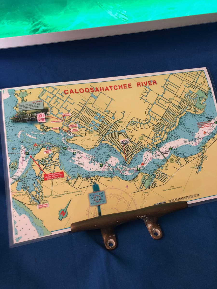
Caloosahatchee River and Pine Island Sound Nautical Chart
$26.00
This chart covers the area of Fort Myers, and Cape Coral, Florida along the Caloosahatchee River with Pine Island Sound on the inside double page of this chart. Highlights include local area restaurants, the State Park on Cayo Costa, Cabbage Key, Pine Island, North Captiva and Sanibel. Enlarged navigation markers along with photographic visuals. The chart measures 17″ x 11″ closed and 17″ x 22″ open. Full uv lamination at 10 mil. “Write-On Wipe-Off! Time after Time” with a Sharpie marker and alcohol. Used by Coast Guard and Coast Guard Auxilliaries, Marinas, Boat Rentals, Boat Clubs, County Sheriffs, Insurance companies, Real Estate and more! Easiest Boating Chart You Will Ever use.
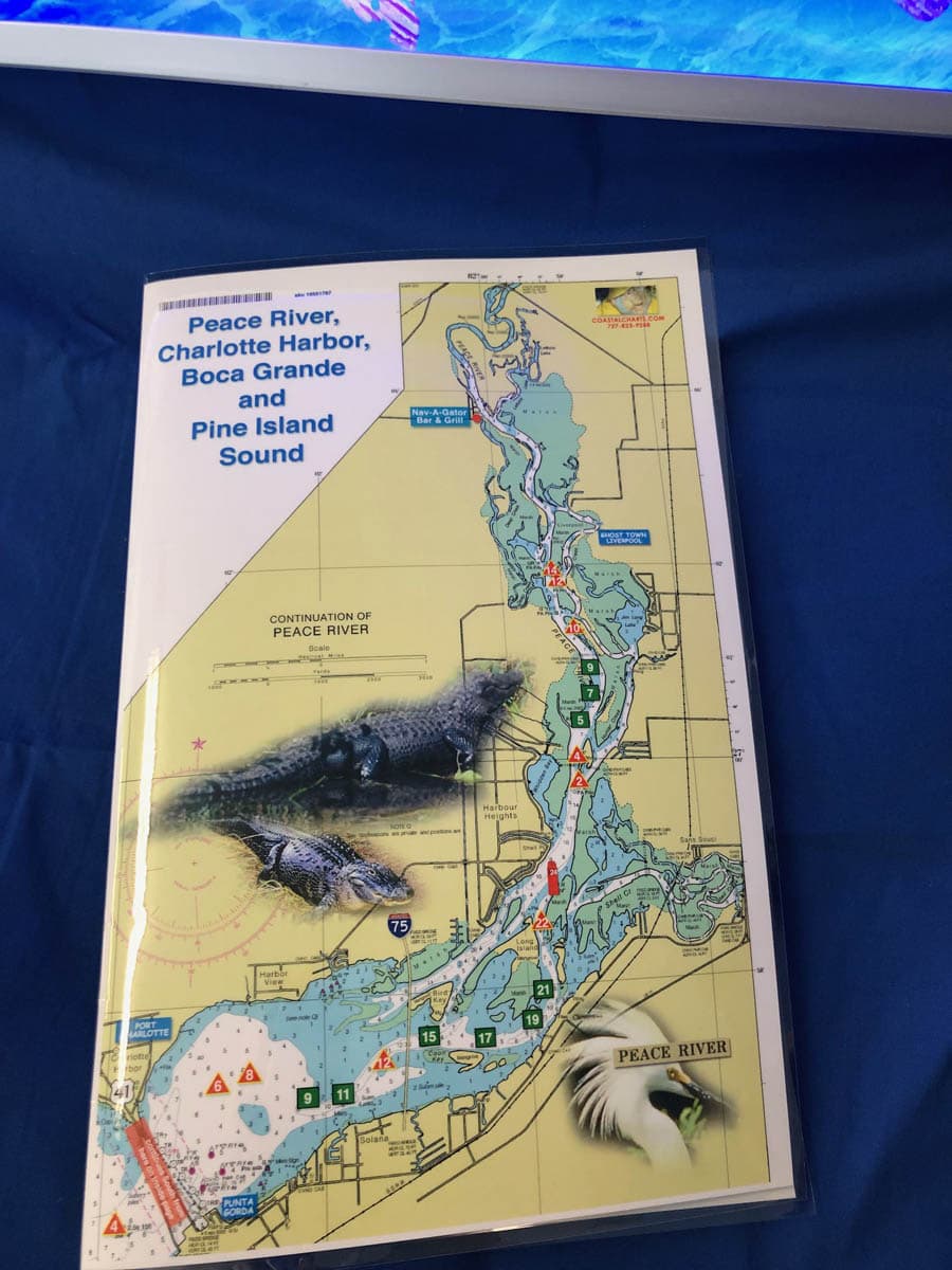
Peace River, Charlotte Harbor and Pine Island Sound Nautical Charts
$26.00
Peace River is on the Front Cover. The double page inside shows all of Charlotte Harbor and Pine Island Sound to Sanibel Island, Florida on the back page. Local area places of interest include Boca Grande, Cabbage Key, Cayo Costa, Tarpon Lodge and Four Winds Marina on Pine Island. Fisherman’s Village in Punta Gorda, Jensen’s historic marina on Captiva and famous Gramma Dot’s Restaurant on Sanibel Island. Enlarged navigation markers along with photographic visuals. The chart measures 11″ x 17″” closed and 22″ x 17″ open. Full uv lamination at 10 mil. “Write-On Wipe-Off! Time after Time” with a Sharpie marker and alcohol. Used by Coast Guard and Coast Guard Auxilliaries, Marinas, Boat Rentals, Boat Clubs, County Sheriffs, Insurance companies, Real Estate and more! Easiest Boating Chart You Will Ever use
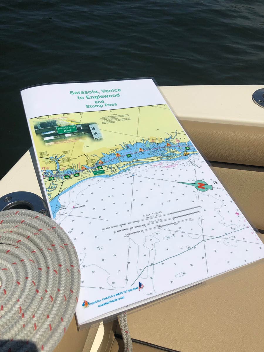
Sarasota, Venice to Englewood and Stump Pass Nautical Charts
$26.00
Little Sarasota Bay south to Venice and Englewood along the intracoastal waterways to Stump Pass. Stump Pass is beautiful and very scenic and a great anchoring spot for boats of all sizes. Enlarged navigation markers along with photographic visuals. The chart measures 11″ x 17″ closed and 22″ x 17″ open. Full uv lamination at 10 mil. “Write-On Wipe-Off! Time after Time” with a Sharpie marker and alcohol. Used by Coast Guard and Coast Guard Auxilliaries, Marinas, Boat Rentals, Boat Clubs, County Sheriffs, Insurance companies, Real Estate and more! Easiest Boating Chart You Will Ever use
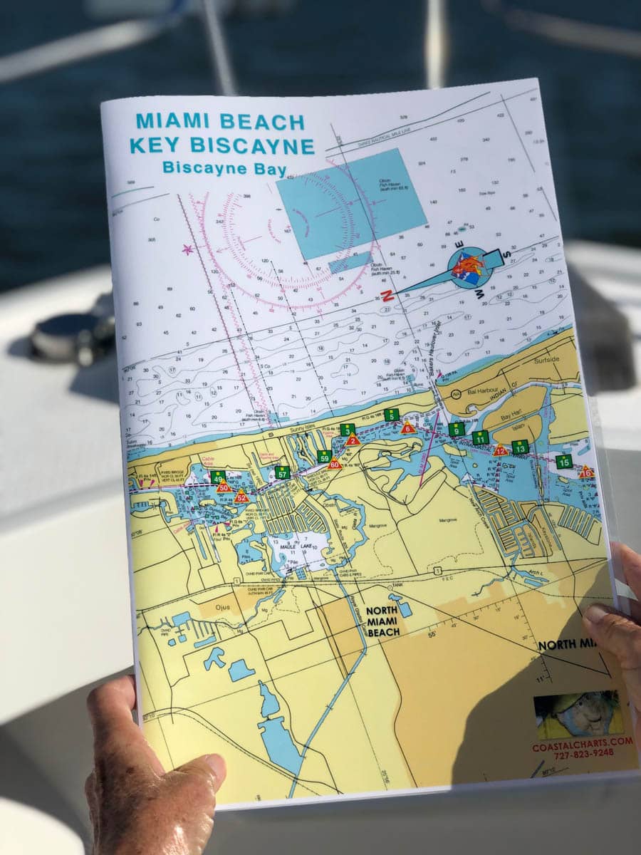
Miami Beach, Key Biscayne and Biscayne Bay Nautical Charts
$26.00
North Miami Beach to Key Biscayne and Coconut Grove. Port of Miami and the ship channel. One mile south of Cape Florida Channel is Stiltsville, wooden stilt houses on sand banks. Enlarged navigation markers along with photographic visuals. The chart measures 11″ x 17″ closed and 22″ x 17″ open. Full uv lamination at 10 mil. “Write-On Wipe-Off! Time after Time” with a Sharpie marker and alcohol. Used by Coast Guard and coast Guard Auxilliaries, Marinas, Boat Rentals, Boat Clubs, County Sheriffs, Insurance companies, Real Estate and more! Easiest Boating Chart You Will Ever Use
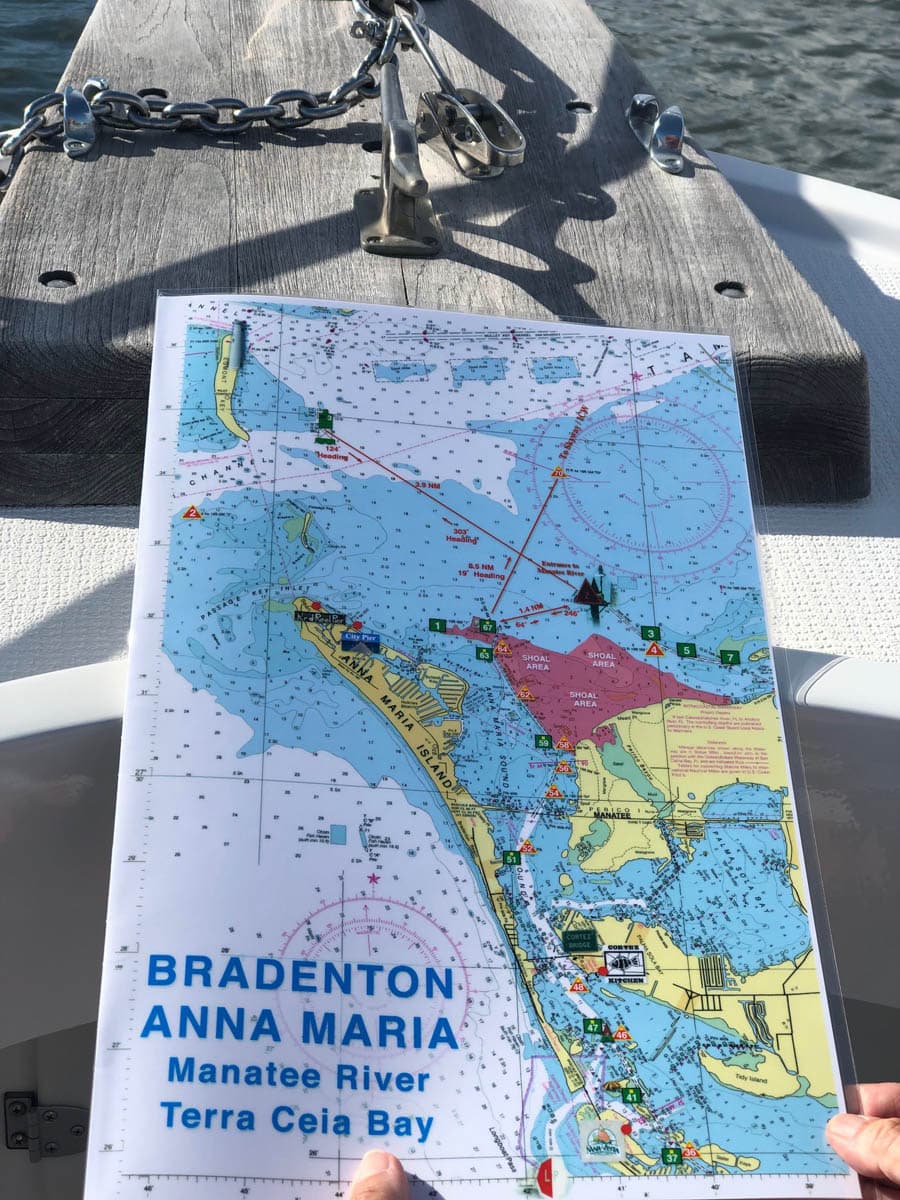
Bradenton, Anna Maria, Manatee River and Terra Ceia Bay Nautical Charts
$26.00
Egmont Key to Bradenton and the Manatee River including the far eastern section and Anna Maria Island to Longboat Pass. Shows Terra Ceia Bay and a hand drawing of Braden River. Enlarged navigation markers along with photographic visuals. The chart measures 11″ x 17″ closed and 22″ x 17″ open. Full uv lamination at 10 mil. “Write-On Wipe-Off! Time after Time” with a Sharpie marker and alcohol. Used by Coast Guard and coast Guard Auxilliaries, Marinas, Boat Rentals, Boat Clubs, County Sheriffs, Insurance companies, Real Estate and more! Easiest Boating Chart You Will Ever Use
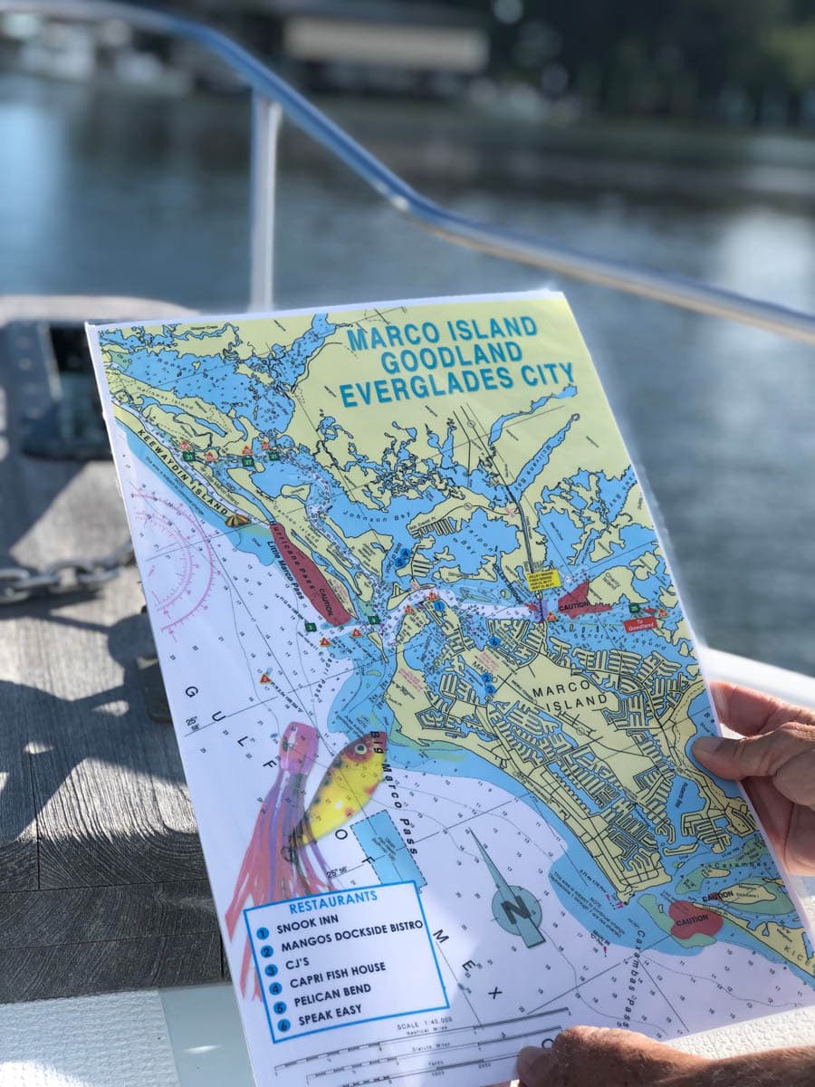
Marco Island, Goodland, Everglades City Nautical Chart
$26.00
Keewaydin Island south to Marco Island, Goodland and Everglades City. Caution areas are highlighted and also a few local restaurants. Enlarged navigation markers along with photographic visuals. The chart measures 11″ x 17″ closed and 22″ x 17″ open. Full uv lamination at 10 mil. “Write-On Wipe-Off! Time after Time” with a Sharpie marker and alcohol. Used by Coast Guard and coast Guard Auxilliaries, Marinas, Boat Rentals, Boat Clubs, County Sheriffs, Insurance companies, Real Estate and more! Easiest Boating Chart You Will Ever Use
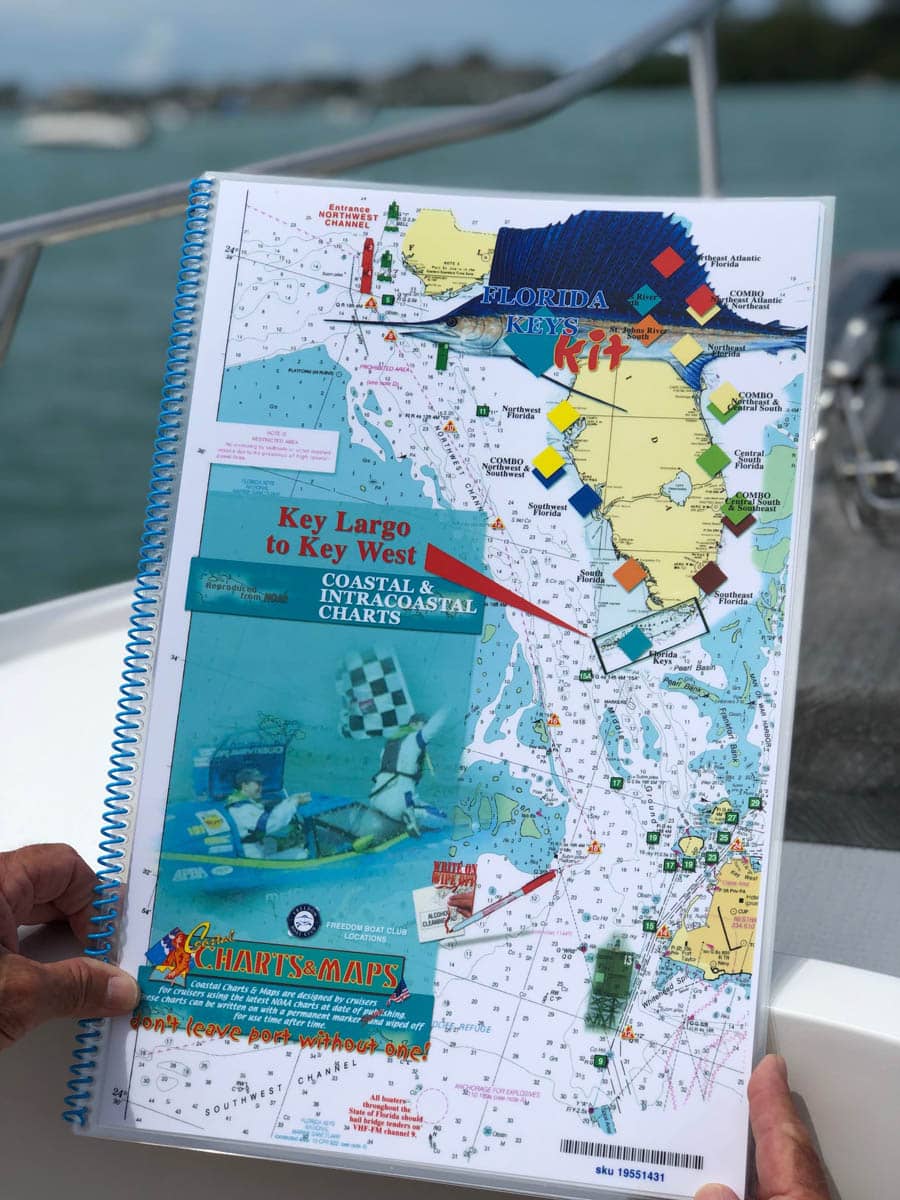
Key West to Key Largo Nautical Chart
$60.00
From Key West north to Bahia Honda Channel where you can take the inside route north to Key Largo or continue on the outside route to Key Largo. You can also take the inside route at Marker 49A at Marathon’s Seven Mile Bridge to continue north. Large scale details of channels and passes and highlighted Mile Markers. Enlarged navigation markers along with photographic visuals. Each page of the chart kit measures 11″ x 17″. Full uv lamination at 10 mil. “Write-On Wipe-Off! Time after Time” with a Sharpie marker and alcohol. Used by Coast Guard and coast Guard Auxilliaries, Marinas, Boat Rentals, Boat Clubs, County Sheriffs, Insurance companies, Real Estate and more! Easiest Boating Chart You Will Ever Use.
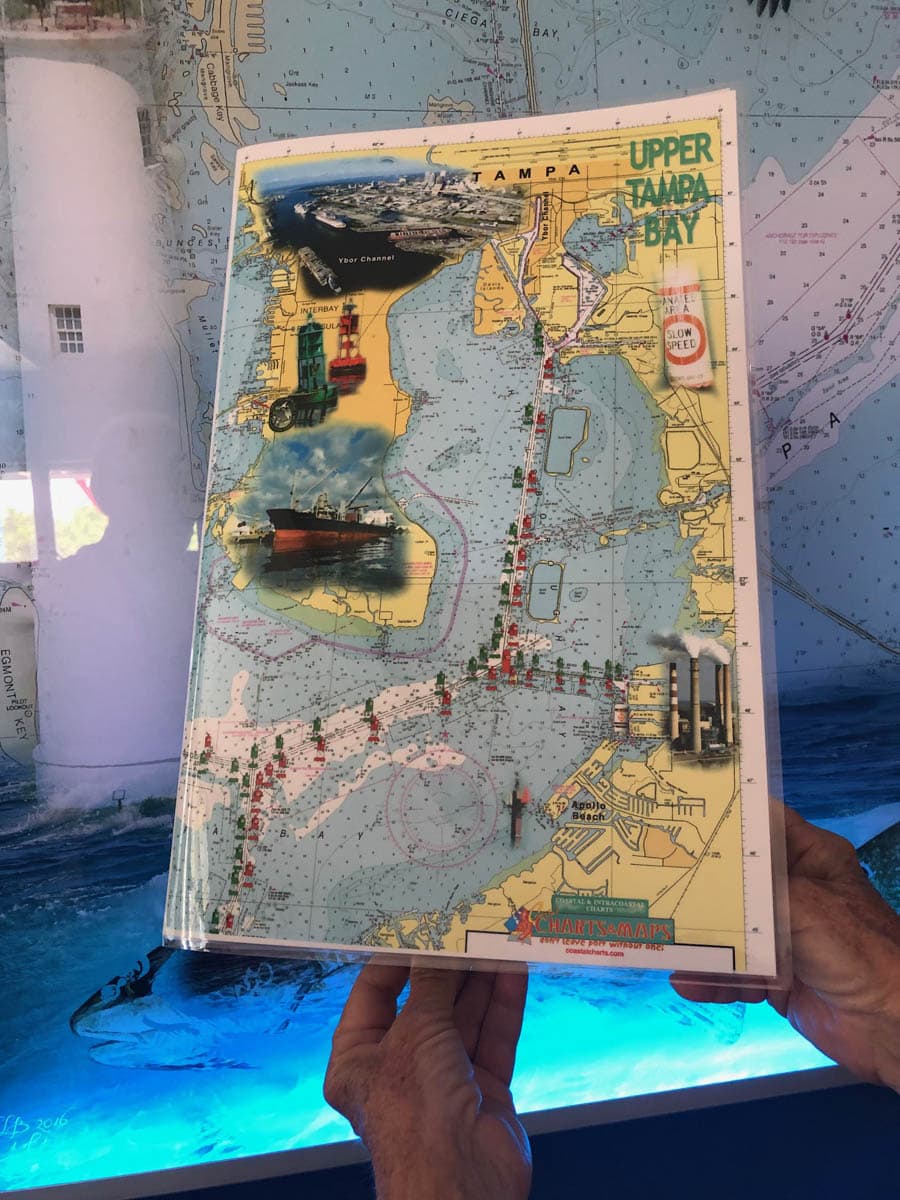
Tampa Bay Nautical Charts – Upper and Lower
$26.00
Tampa Bay Upper and Lower. The complete bay. In and around Tampa and St Petersburg, Apollo Beach to the Beaches. If you boat on Tampa Bay this is a “Must Have” boating chart. Enlarged navigation markers along with photographic visuals. The chart measures 11″ x 17″ closed and 22″ x 17″ open. Full uv lamination at 10 mil. “Write-On Wipe-Off! Time after Time” with a Sharpie marker and alcohol. Used by Coast Guard and coast Guard Auxilliaries, Marinas, Boat Rentals, Boat Clubs, County Sheriffs, Insurance companies, Real Estate and more! Easiest Boating Chart You Will Ever Use
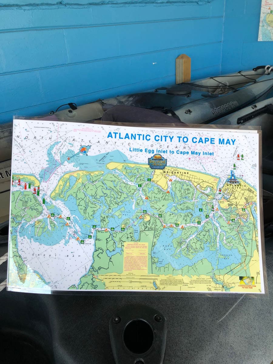
Atlantic City to Cape May Nautical Chart
$26.00
Atlantic City to Cape May Chart showing Little Egg Inlet to Cape May Inlet from the Atlantic Ocean. The Intracoastal Waterway has highlighted markers for easier navigation along with photographic visuals. The chart measures 17″ x 11″ closed and 34″ x 11″ open. Full uv lamination at 10 mil. “Write-On Wipe-Off! Time after Time” with a Sharpie marker and alcohol. Used by Coast Guard and coast Guard Auxilliaries, Marinas, Boat Rentals, Boat Clubs, County Sheriffs, Insurance companies, Real Estate and more! Easiest Boating Chart You Will Ever Use
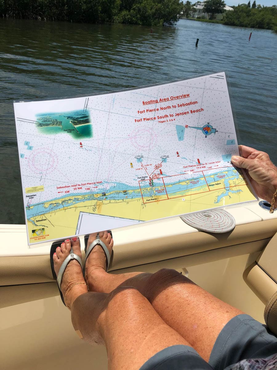
Fort Pierce to Jensen Beach Nautical Chart
$26.00
The front cover of this chart is a boating area overview from Fort Pierce Inlet North to Sebastian Inlet and Fort Pierce Inlet South to St. Lucie Inlet. This overview also shows mileage to a few fish havens. The inside of the chart and the back cover show detailed information from Fort Pierce to Jensen Beach and the St. Lucie Inlet. The chart measures 17″ x 11″ closed and 34″ x 11″ open. Full uv lamination at 10 mil. “Write-On Wipe-Off! Time after Time” with a Sharpie marker and alcohol. Used by Coast Guard and coast Guard Auxilliaries, Marinas, Boat Rentals, Boat Clubs, County Sheriffs, Insurance companies, Real Estate and more! Easiest Boating Chart You Will Ever Use
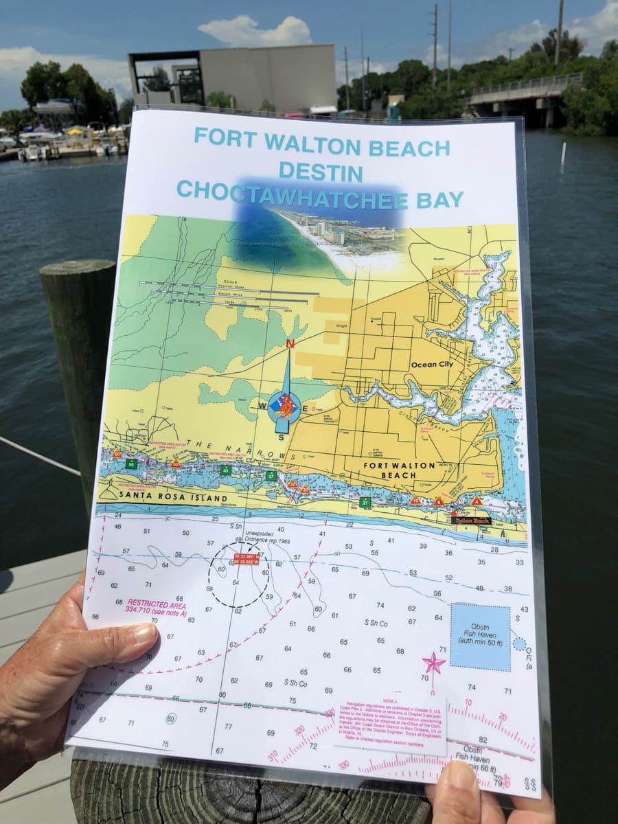
Choctawhatchee Bay Nautical Chart – Fort Walton Beach and Destin
$26.00
Fort Walton Beach and Destin and the Choctawhatchee Bay to Santa Rosa Beach, Freeport and Point Washington. Enlarged navigation markers along with photographic visuals. The chart measures 11″ x 17″ closed and 22″ x 17″ open. Full uv lamination at 10 mil. “Write-On Wipe-Off! Time after Time” with a Sharpie marker and alcohol. Used by Coast Guard and coast Guard Auxilliaries, Marinas, Boat Rentals, Boat Clubs, County Sheriffs, Insurance companies, Real Estate and more! Easiest Boating Chart You Will Ever Use
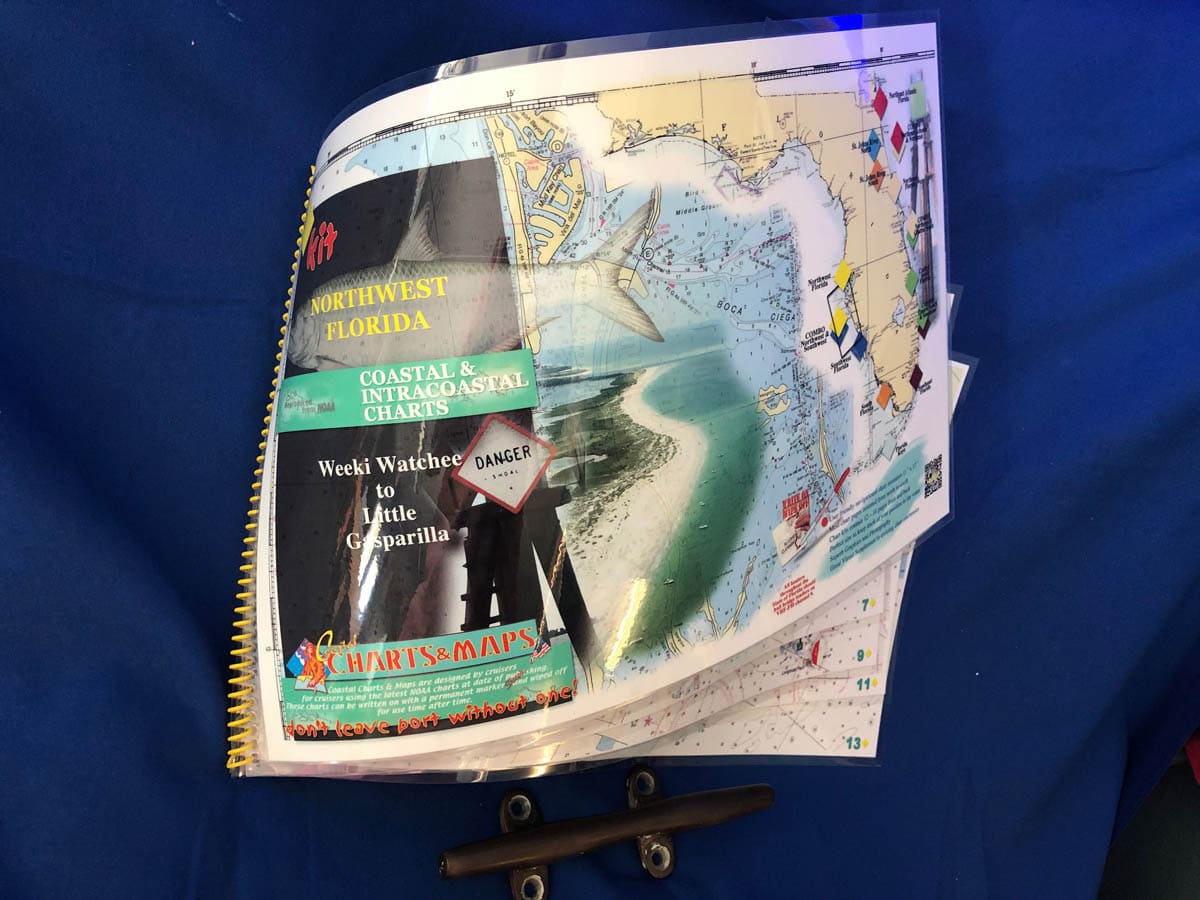
Northwest Florida Nautical Chart Kit – Tarpon Springs to Gasparilla Island
$60.00
The Northwest Florida Coastal Chart Kit starts with a 1:80,000 scale chart of Weeki Wachee. The balance of the chart kit is 1: 40,000 scale traveling south from Port Richey, Tarpon Springs and Clearwater navigating the intracoastal waterway to the mouth of Tampa Bay and the beautiful Sunshine Skyway Bridge. Crossing the mouth of Tampa Bay to the Manatee River or to Longboat Key, Sarasota and south as far as Venice and Gasparilla Island. Enlarged navigation markers along with photographic visuals. Each page of the chart kit measures 17″ x 11″. Full uv lamination at 10 mil. “Write-On Wipe-Off! Time after Time” with a Sharpie marker and alcohol. Used by Coast Guard and coast Guard Auxilliaries, Marinas, Boat Rentals, Boat Clubs, County Sheriffs, Insurance companies, Real Estate and more! Easiest Boating Chart You Will Ever Use
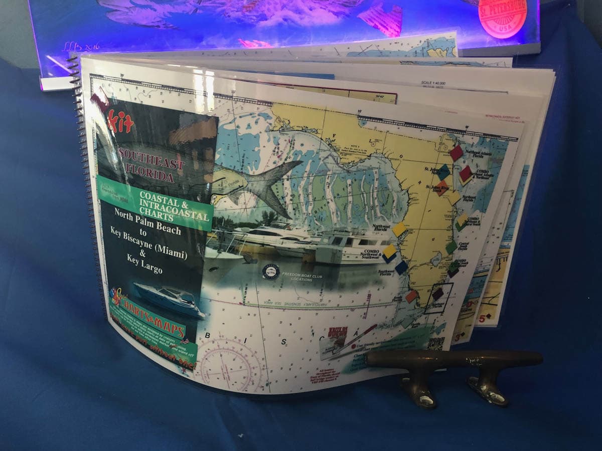
Southeast Florida Nautical Chart Kit – North Palm Beach to Key Biscayne, Miami Beach and Key Largo
$60.00
North Palm Beach on the Intracoastal Waterway south to Ft. Lauderdale and Miami Beach, Biscayne Bay and Key Largo. Visuals of Lake Worth Inlet, Boynton Inlet, Boca Raton Inlet. Enlarged navigation markers along with photographic visuals. Each page of the chart kit measures 17″ x 11″. Full uv lamination at 10 mil. “Write-On Wipe-Off! Time after Time” with a Sharpie marker and alcohol. Used by Coast Guard and coast Guard Auxilliaries, Marinas, Boat Rentals, Boat Clubs, County Sheriffs, Insurance companies, Real Estate and more! Easiest Boating Chart You Will Ever Use
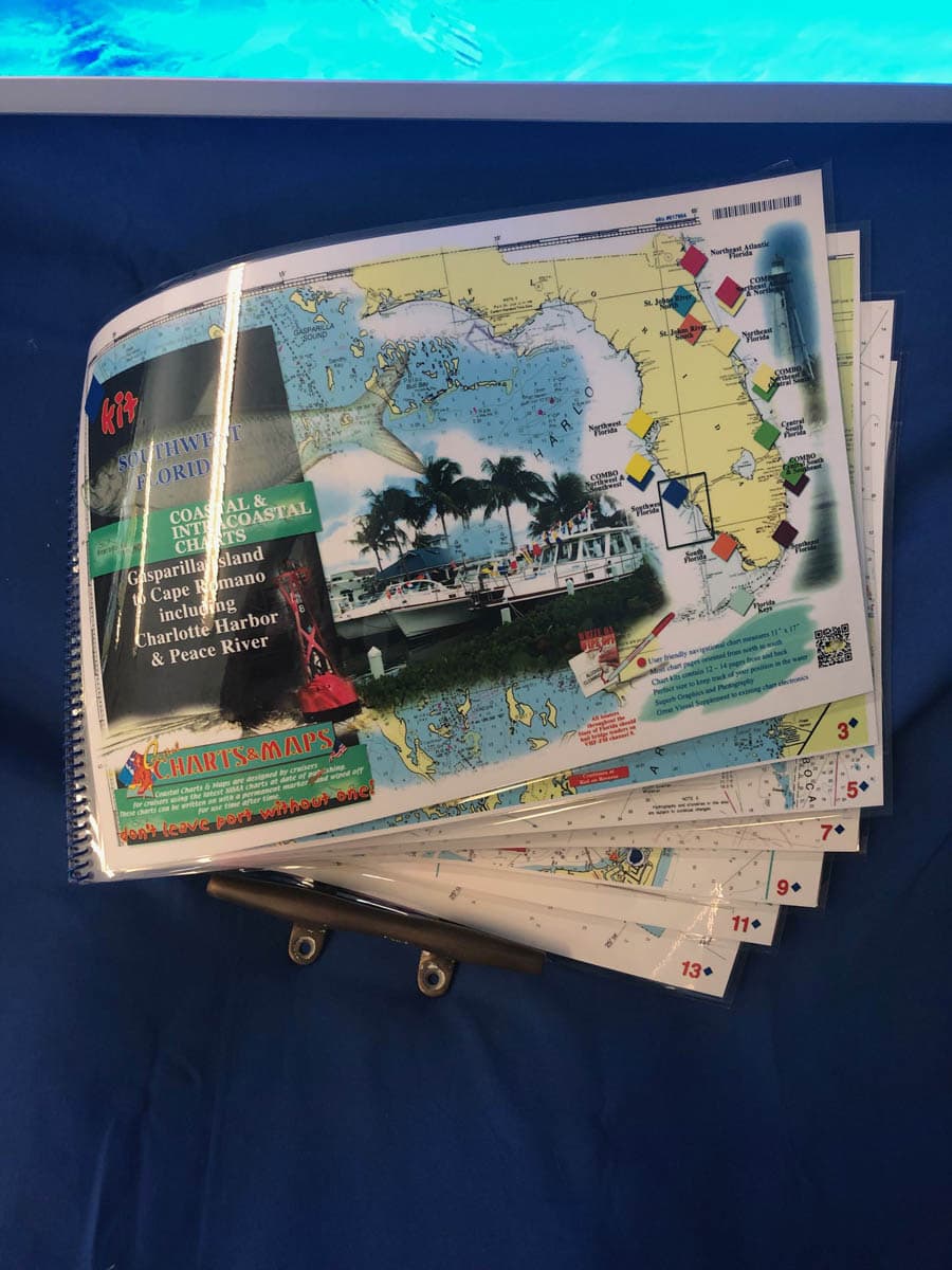
Southwest Florida Nautical Chart Kit – Gasparilla Island, Boca Grande, Charlotte Harbor, Peace River to Marco Island
$60.00
Gasparilla Island, Boca Grande including Charlotte Harbor, Peace River and south to Cayo Costa, Pine Island Sound, Captiva, Sanibel and Ft. Myers Beach. Exit San Carlos Bay at Sanibel Island to travel the coast south to Gordon Pass and Naples, Marco Island and Goodland. Enlarged navigation markers along with photographic visuals. Each page of the chart kit measures 17″ x 11″. Full uv lamination at 10 mil. “Write-On Wipe-Off! Time after Time” with a Sharpie marker and alcohol. Used by Coast Guard and coast Guard Auxilliaries, Marinas, Boat Rentals, Boat Clubs, County Sheriffs, Insurance companies, Real Estate and more! Easiest Boating Chart You Will Ever Use
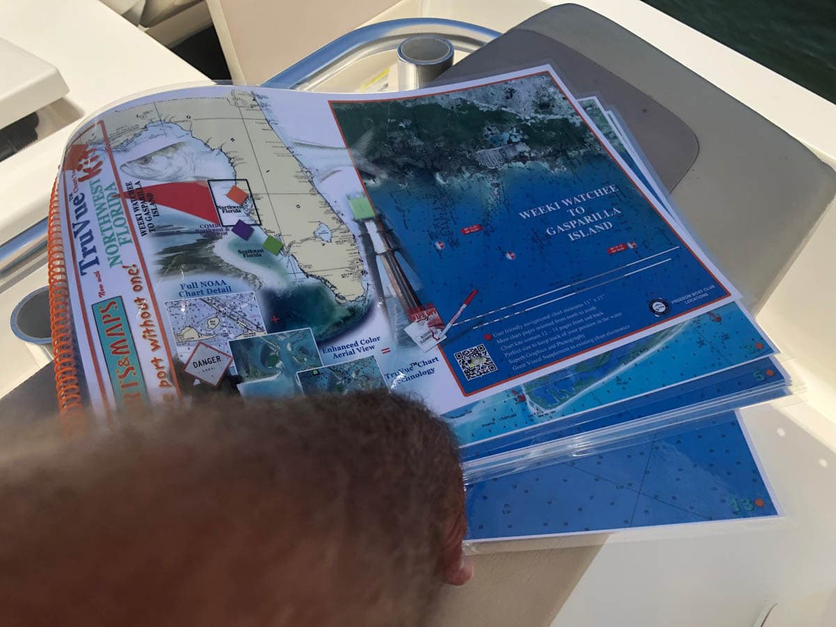
Truvue Northwest Florida Nautical Chart Kit – Weeki Watchee to Gasparilla Island
$60.00
This chart kit covers the same area as the the Northwest Florida Chart Kit but it is enhanced with satellite imagery. The Northwest Florida TRUVUE Chart Kit starts with a 1:80,000 scale chart of Weeki Wachee. The balance of the chart kit is 1: 40,000 scale traveling south from Port Richey, Tarpon Springs and Clearwater navigating the intracoastal waterway to the mouth of Tampa Bay and the beautiful Sunshine Skyway Bridge. Crossing the mouth of Tampa Bay to the Manatee River or to Longboat Key, Sarasota and south as far as Venice and Gasparilla Island. Enlarged navigation markers along with photographic visuals. Each page of the chart kit measures 17″ x 11″. Full uv lamination at 10 mil. “Write-On Wipe-Off! Time after Time” with a Sharpie marker and alcohol. Used by Coast Guard and coast Guard Auxilliaries, Marinas, Boat Rentals, Boat Clubs, County Sheriffs, Insurance companies, Real Estate and more! Easiest Boating Chart You Will Ever Use
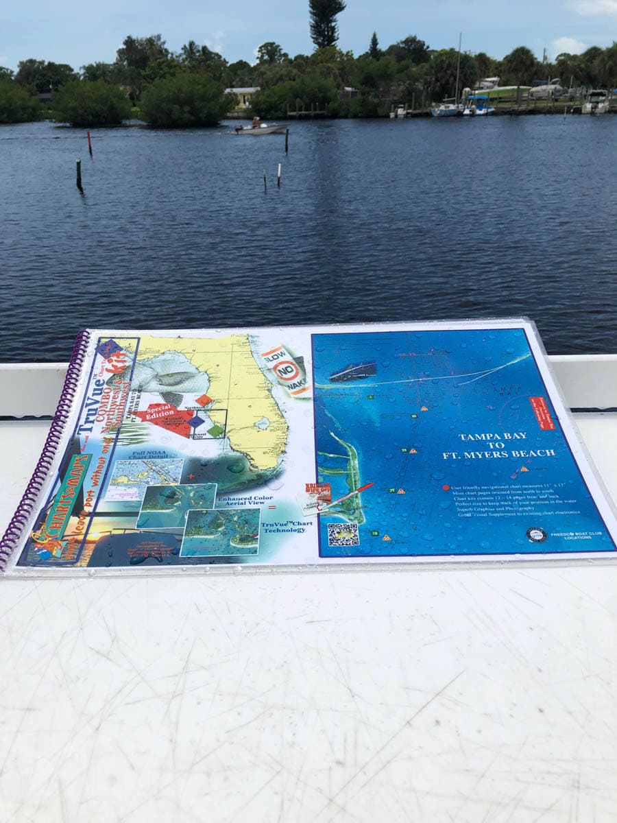
Truvue Combo Northwest and Southwest Florida Nautical Chart Kit – Tampa Bay To Ft. Myers Beach Including Charlotte Harbor and Pine Island Sound
$60.00
This chart kit covers the area from Tampa Bay to Ft. Myers Beach and is enhanced with satellite imagery. On the last 2 pages of this chart kit is upper Charlotte Harbor, lower Charlotte Harbor and an overview of Pine Island Sound. Enlarged navigation markers along with photographic visuals. Each page of the chart kit measures 17″ x 11″. Full uv lamination at 10 mil. “Write-On Wipe-Off! Time after Time” with a Sharpie marker and alcohol. Used by Coast Guard and coast Guard Auxilliaries, Marinas, Boat Rentals, Boat Clubs, County Sheriffs, Insurance companies, Real Estate and more! Easiest Boating Chart You Will Ever Use
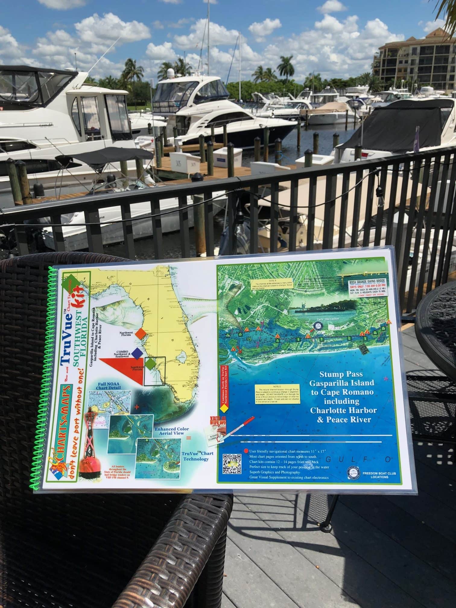
Truvue Southwest Florida Nautical Chart Kit – Stump Pass, Gasparilla Island to Cape Romano Including Charlotte Harbor and Peace River
$60.00
This chart kit enhanced with satellite imagery covers the area from Stump Pass and Lemon Bay to Gasparilla Island, Boca Grande south to Goodland and Cape Romano including Charlotte Harbor and Peace River. Enlarged navigation markers along with photographic visuals. Each page of the chart kit measures 17″ x 11″. Full uv lamination at 10 mil. “Write-On Wipe-Off! Time after Time” with a Sharpie marker and alcohol. Used by Coast Guard and coast Guard Auxilliaries, Marinas, Boat Rentals, Boat Clubs, County Sheriffs, Insurance companies, Real Estate and more! Easiest Boating Chart You Will Ever Use
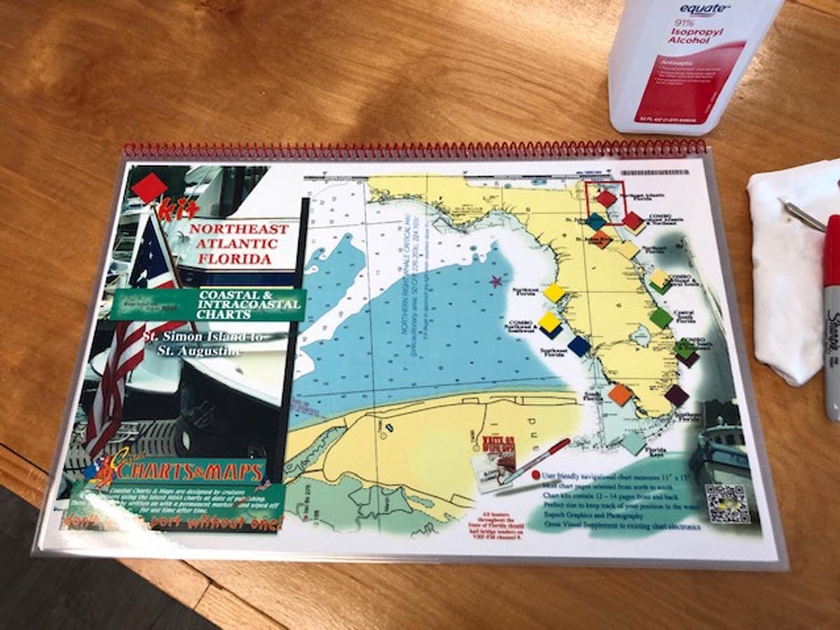
Northeast Atlantic Florida Nautical Chart Kit – St. Simon Island to St. Augustine
$60.00
Traveling south from St. Simons Island and crossing St. Simons Sound to Jekyll Island and St. Andrew Sound continuing south along the intracoastal waterway to St. Augustine. Enlarged navigation markers along with photographic visuals. Each page of the chart kit measures 17″ x 11″. Full uv lamination at 10 mil. “Write-On Wipe-Off! Time after Time” with a Sharpie marker and alcohol. Used by Coast Guard and coast Guard Auxilliaries, Marinas, Boat Rentals, Boat Clubs, County Sheriffs, Insurance companies, Real Estate and more! Easiest Boating Chart You Will Ever Use
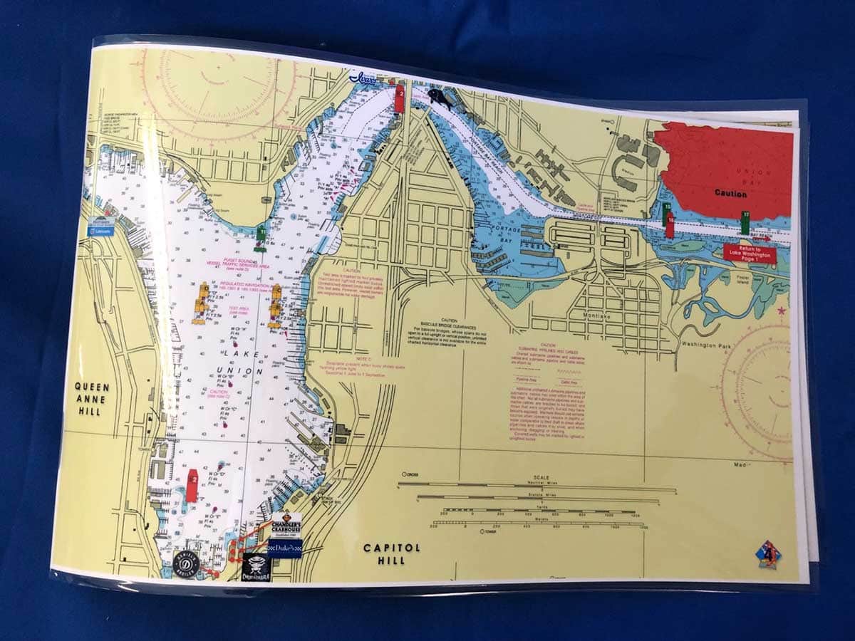
Lake Washington and Lake Union Nautical Chart
$26.00
Lake Washington and Lake Union off of Kirkland, Washington and Mercer Island including Hiram M Chittenden Locks to Seattle. Enlarged navigation markers along with photographic visuals. Each page of the chart measures 17″ x 11″. Full uv lamination at 10 mil. “Write-On Wipe-Off! Time after Time” with a Sharpie marker and alcohol. Used by Coast Guard and coast Guard Auxilliaries, Marinas, Boat Rentals, Boat Clubs, County Sheriffs, Insurance companies, Real Estate and more! Easiest Boating Chart You Will Ever Use
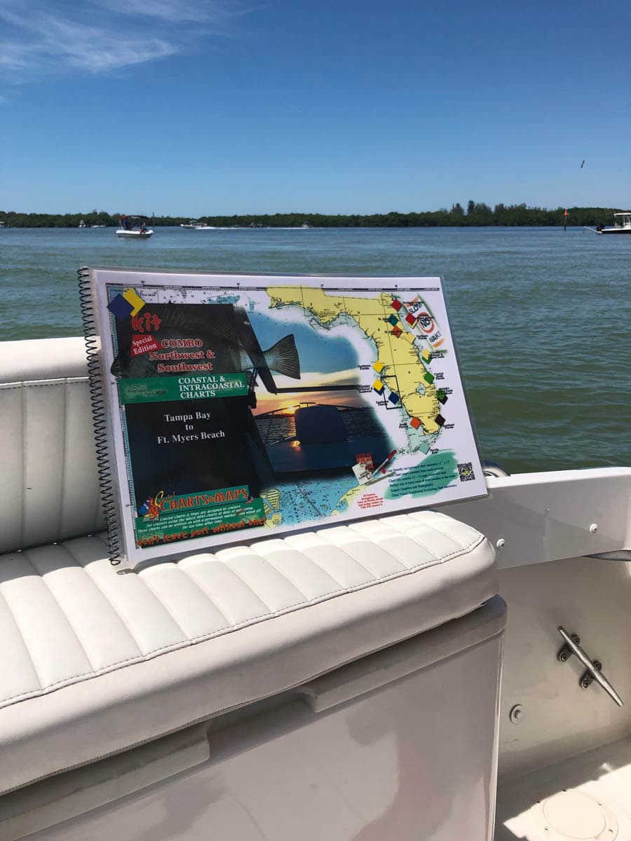
Combo Northwest Florida Southwest Florida Nautical Chart Kit – Tampa Bay to Fort Myers Beach
$60.00
This combination chart kit includes the southern part of the Northwest Florida Chart Kit and the northern part of the Southwest Florida Chart Kit from Tampa Bay to Fort Myers Beach. We make this special edition chart kit for the boaters that boat in the areas of of 2 chart kits so we combine sections from 2 chart kits. Enlarged navigation markers along with photographic visuals. Each page of the chart kit measures 17″ x 11″. Full uv lamination at 10 mil. “Write-On Wipe-Off! Time after Time” with a Sharpie marker and alcohol. Used by Coast Guard and coast Guard Auxilliaries, Marinas, Boat Rentals, Boat Clubs, County Sheriffs, Insurance companies, Real Estate and more! Easiest Boating Chart You Will Ever Use
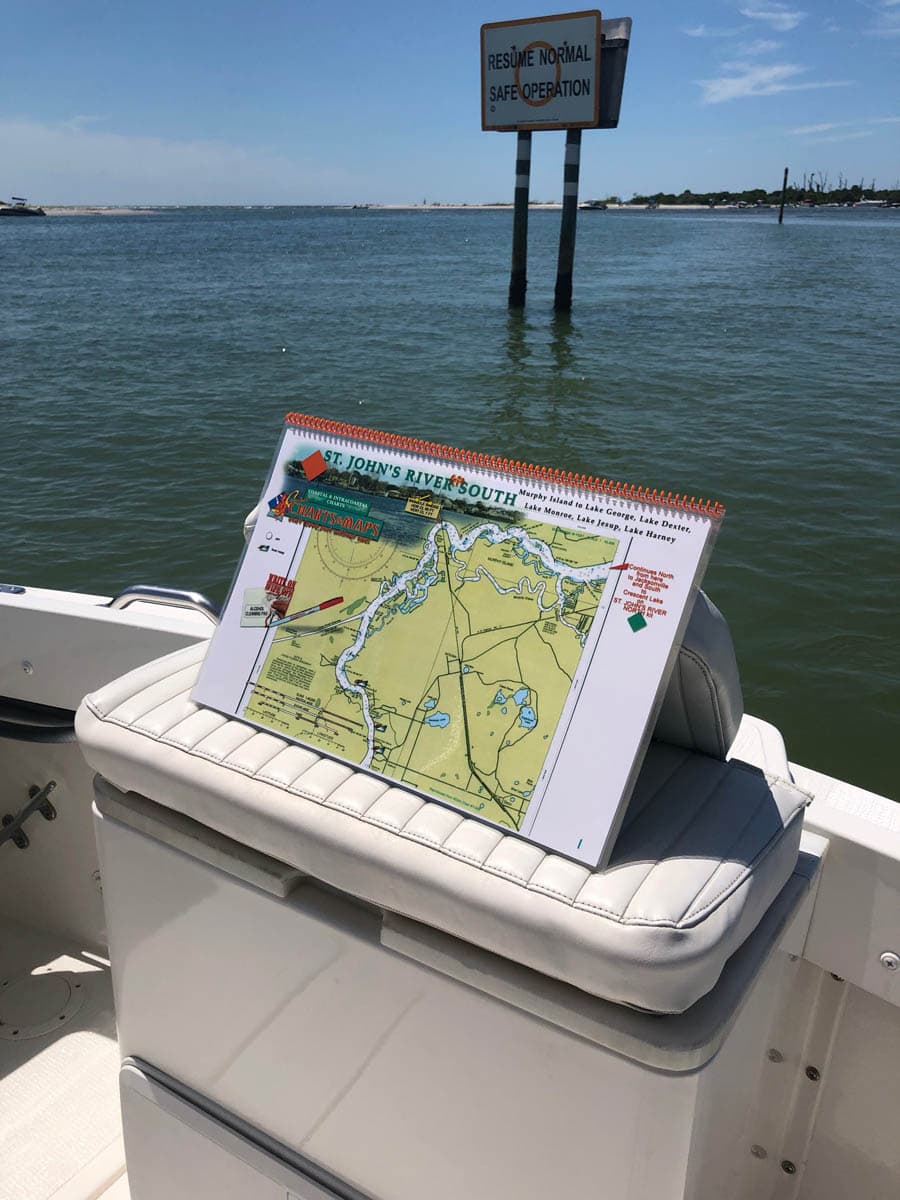
St Johns River South Nautical Charts – Murphy Island To Lake George, Lake Dexter, Lake Monroe, Lake Jesup, Lake Harnery
$54.00
Travels along the southern shore of the St. Johns River from Murphy Island to Lake George, Lake Dexter, Lake Monroe, Lake Jesup, Lake Harney. Enlarged navigation markers along with photographic visuals. Each page of the chart kit measures 17″ x 11″. Full uv lamination at 10 mil. “Write-On Wipe-Off! Time after Time” with a Sharpie marker and alcohol. Used by Coast Guard and coast Guard Auxilliaries, Marinas, Boat Rentals, Boat Clubs, County Sheriffs, Insurance companies, Real Estate and more! Easiest Boating Chart You Will Ever Use
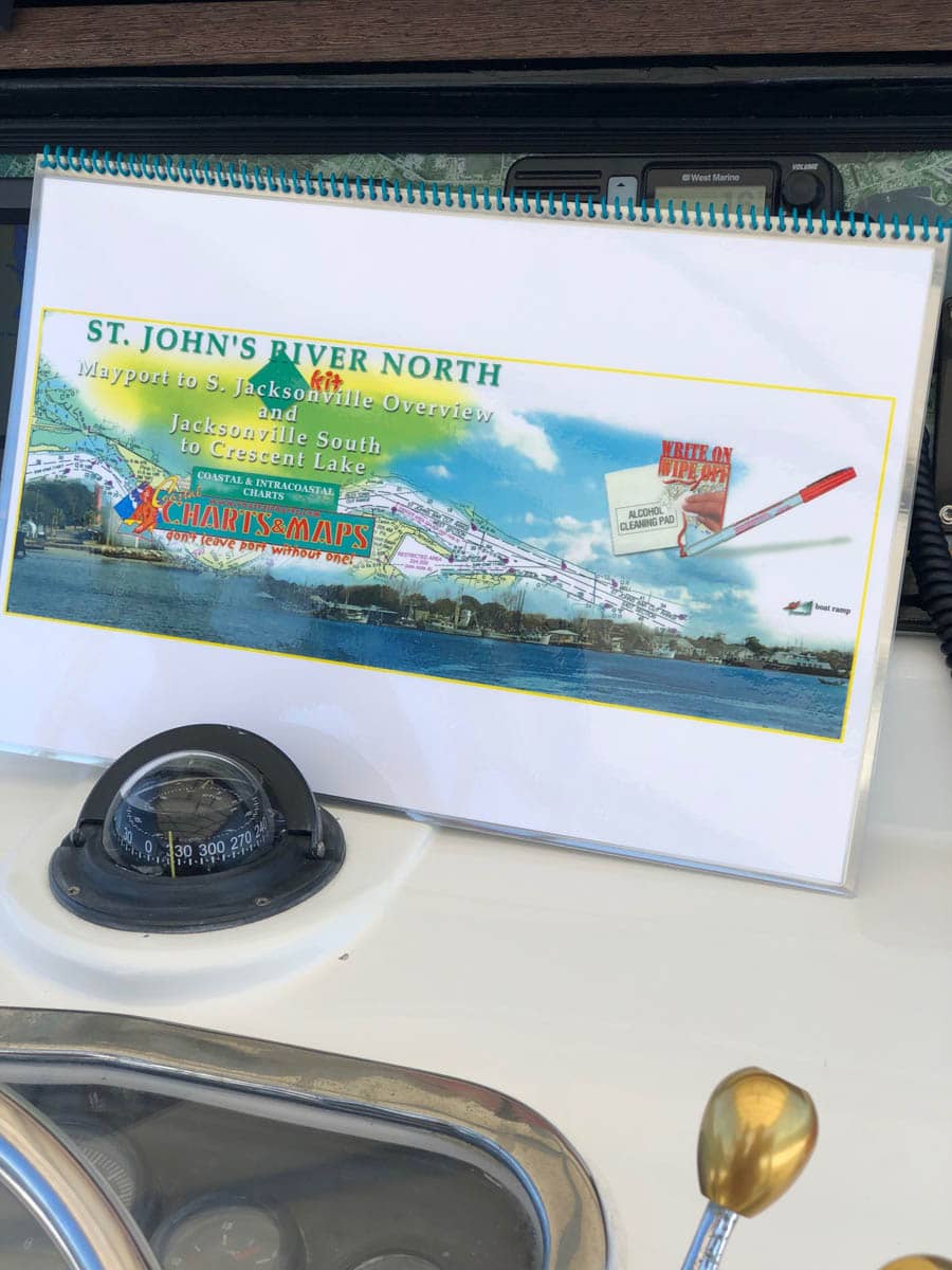
St Johns River North Nautical Chart – Mayport to South Jacksonville Overview and Jacksonville South to Crescent Lake
$60.00
St Johns River Entrance to downtown Jacksonville and continuing south to Oranage Park, Palatka, Murphy Island and Crescent Lake. Enlarged navigation markers along with photographic visuals. Each page of the chart kit measures 17″ x 11″. Full uv lamination at 10 mil. “Write-On Wipe-Off! Time after Time” with a Sharpie marker and alcohol. Used by Coast Guard and coast Guard Auxilliaries, Marinas, Boat Rentals, Boat Clubs, County Sheriffs, Insurance companies, Real Estate and more! Easiest Boating Chart You Will Ever Use
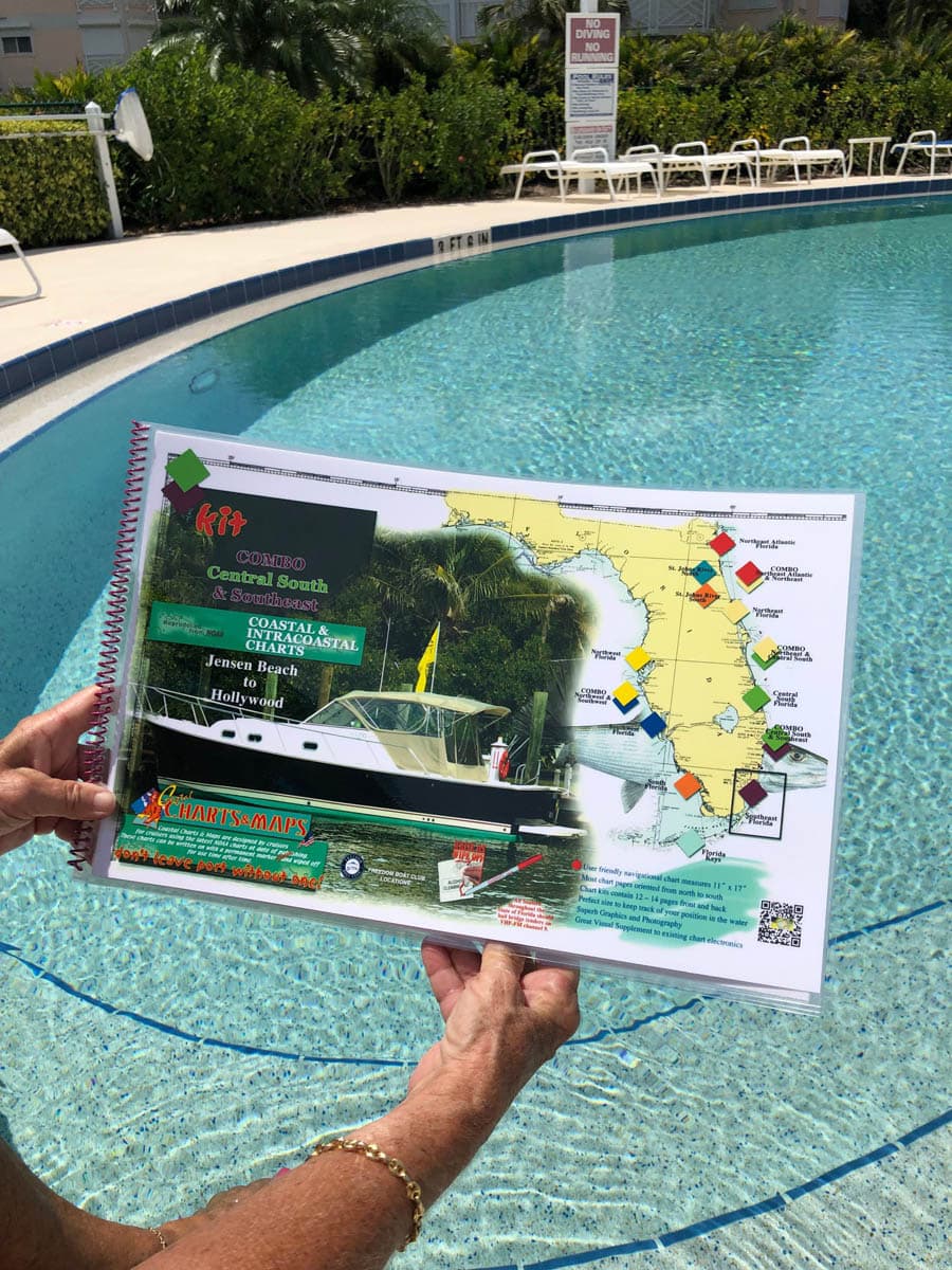
Combo Central South and Southeast Florida Navigational Chart Kit – Jensen Beach to Hollywood and North Miami Beach
$60.00
Jensen Beach, Hutchinson Island, St. Lucie Inlet. This chart kit has the route down the St. Lucie River and thru the St. Lucie Canal to Lake Okeechobee. South to Jupiter Inlet to Lake Worth Inlet, Lake Park and Palm Beach, Boynton Beach, Delray Beach, Boca Raton and Boca Raton Inlet, Pompano Beach, Ft. Lauderdale to Hollywood and ends at North Miami Beach. Enlarged navigation markers along with photographic visuals. Each page of the chart kit measures 17″ x 11″. Full uv lamination at 10 mil. “Write-On Wipe-Off! Time after Time” with a Sharpie marker and alcohol. Used by Coast Guard and coast Guard Auxilliaries, Marinas, Boat Rentals, Boat Clubs, County Sheriffs, Insurance companies, Real Estate and more! Easiest Boating Chart You Will Ever Use
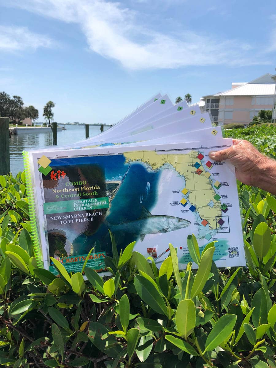
Combo Northeast Florida and Central South Florida Nautical Chart – New Smyrna Beach to Ft. Pierce Along The Indian River
$60.00
New Smyrna Beach south through the Indian River to Mosquito Lagoon through Haulover Canal to Titusville. Indian River continues south to Merritt Island, Palm Shores, Melbourne, Sebastian along the Intracoastal Waterway south to Vero Beach, Hutchinson Island and Ft. Pierce Inlet. Enlarged navigation markers along with photographic visuals. Each page of the chart kit measures 17″ x 11″. Full uv lamination at 10 mil. “Write-On Wipe-Off! Time after Time” with a Sharpie marker and alcohol. Used by Coast Guard and coast Guard Auxilliaries, Marinas, Boat Rentals, Boat Clubs, County Sheriffs, Insurance companies, Real Estate and more! Easiest Boating Chart You Will Ever Use

Central South Florida Nautical Chart Kit – Palm Shores to North Palm Beach
$60.00
This Central South Florida chart kit continues south on the Intracoastal Waterway and the Indian River from Palm Shores to North Palm Beach and in between are Palm Bay, Sebastian, Vero Beach, Fort Pierce and Fort Pierce Inlet, Hutchinson Island, St. Lucie, St. Lucie Inlet and St. Lucie River to Lake Okeechobee and the Loxahatchee River at Jupiter. Enlarged navigation markers along with photographic visuals. Each page of the chart kit measures 17″ x 11″. Full uv lamination at 10 mil. “Write-On Wipe-Off! Time after Time” with a Sharpie marker and alcohol. Used by Coast Guard and coast Guard Auxilliaries, Marinas, Boat Rentals, Boat Clubs, County Sheriffs, Insurance companies, Real Estate and more! Easiest Boating Chart You Will Ever Use
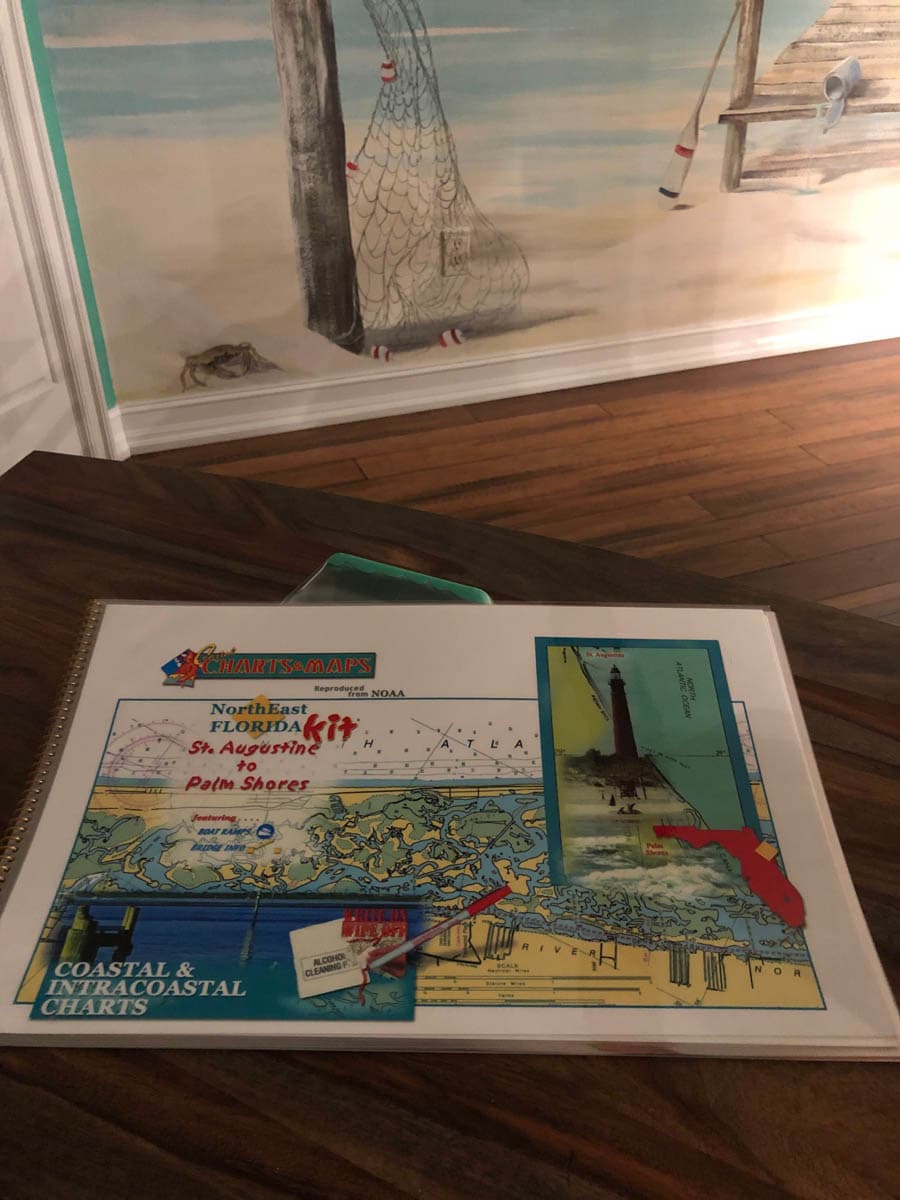
Northeast Florida Nautical Chart Kit – St. Augustine to Palm Shores
$60.00
South from the St. Augustine Inlet on the Intracoastal Waterway and Matanzas River to Palm Shores including Flagler Beach, Ormond Beach, Daytona Beach along the Halifax River to Port Orange, Ponce de Leon Inlet and New Smyrna Beach joining the Indian River and Mosquito Lagoon and Haulover Canal to Titusville, Merritt Island and ending at Palm Shores. Enlarged navigation markers along with photographic visuals. Each page of the chart kit measures 17″ x 11″. Full uv lamination at 10 mil. “Write-On Wipe-Off! Time after Time” with a Sharpie marker and alcohol. Used by Coast Guard and coast Guard Auxilliaries, Marinas, Boat Rentals, Boat Clubs, County Sheriffs, Insurance companies, Real Estate and more! Easiest Boating Chart You Will Ever Use
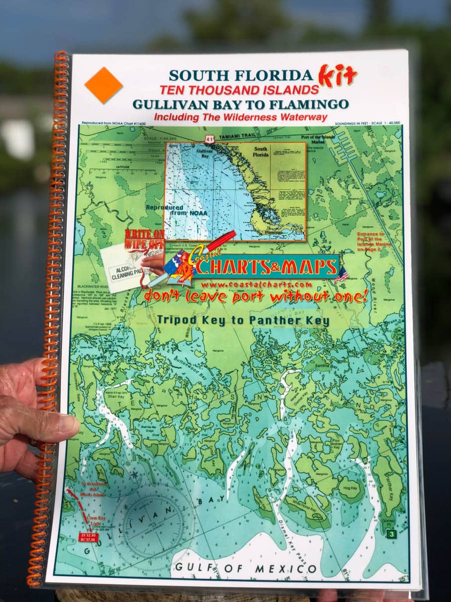
South Florida Nautical Chart Kit – Ten Thousand Islands Gullivan Bay to Flamingo Including the Wilderness Waterway
$60.00
South Florida Chart Kit and Ten Thousand Islands from Gullivan Bay to Flamingo. Welcome to Everglades City and the Wilderness Waterway showing the campgrounds to Flamingo. The last page of the chart kit gives headings and mileage to Marathon and Long Key. Enlarged navigation markers along with photographic visuals. Each page of the chart kit measures 17″ x 11″. Full uv lamination at 10 mil. “Write-On Wipe-Off! Time after Time” with a Sharpie marker and alcohol. Used by Coast Guard and coast Guard Auxilliaries, Marinas, Boat Rentals, Boat Clubs, County Sheriffs, Insurance companies, Real Estate and more! Easiest Boating Chart You Will Ever Use
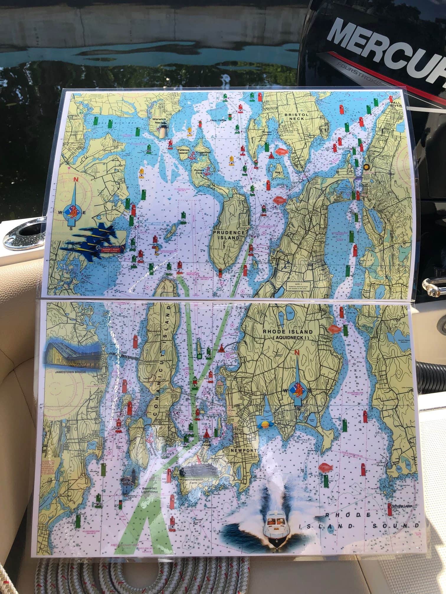
Rhode Island Nautical Chart
$26.00
This 2 page chart covers all of Narragansett Bay north of Rhode Island Sound. From Newport to Providence. Small parts of it extend into Massachusetts. Enlarged navigation markers along with photographic visuals. Each page of the chart measures 17″ x 11″. Full uv lamination at 10 mil. “Write-On Wipe-Off! Time after Time” with a Sharpie marker and alcohol. Used by Coast Guard and Coast Guard Auxilliaries, Marinas, Boat Rentals, Boat Club, County Sheriffs, Insurance Companies, Real Estate and more. Easiest Boating Chart You Will Ever Use
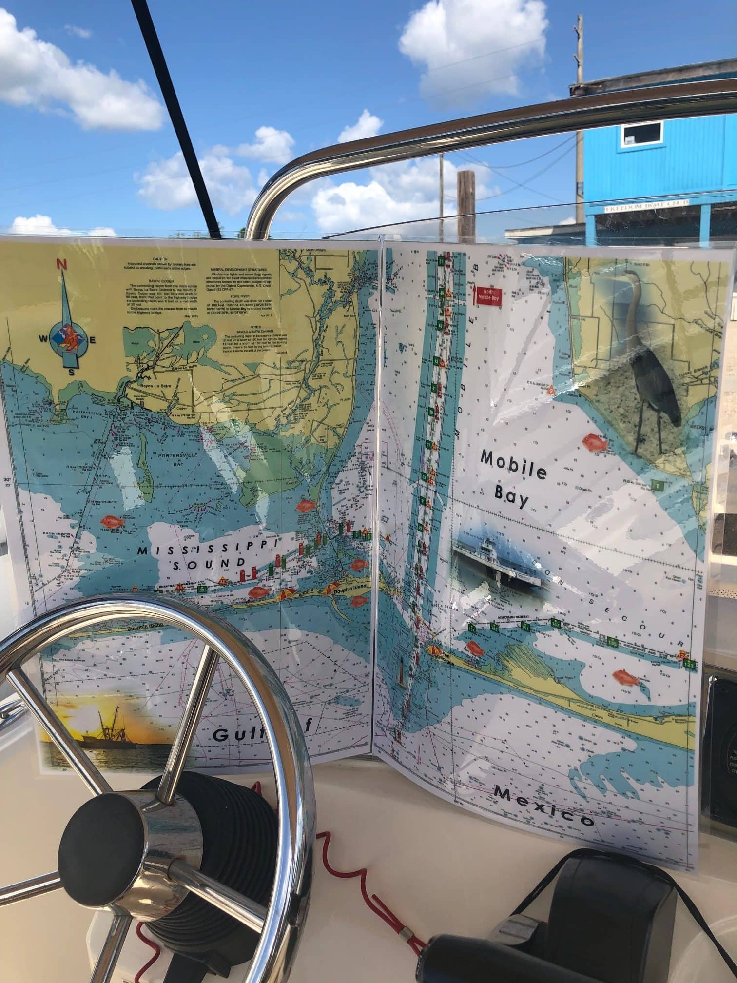
Mobile Bay Alabama Nautical Chart
$26.00
Features all of Mobile Bay North from Mobile, Alabama to the inlet of the Gulf of Mexico with Fort Morgan Peninsula on the eastern side and Dauphin Island, a barrier island on the western side. Enlarged navigation markers along with photographic visuals. Each page of the chart measures 17″ x 11″. Full uv lamination at 10 mil. “Write-On Wipe-Off! Time after Time” with a Sharpie marker and alcohol. Used by Coast Guard and Coast Guard Auxilliaries, Marinas, Boat Rentals, Boat Club, County Sheriffs, Insurance Companies, Real Estate and more. Easiest Boating Chart You Will Ever Use
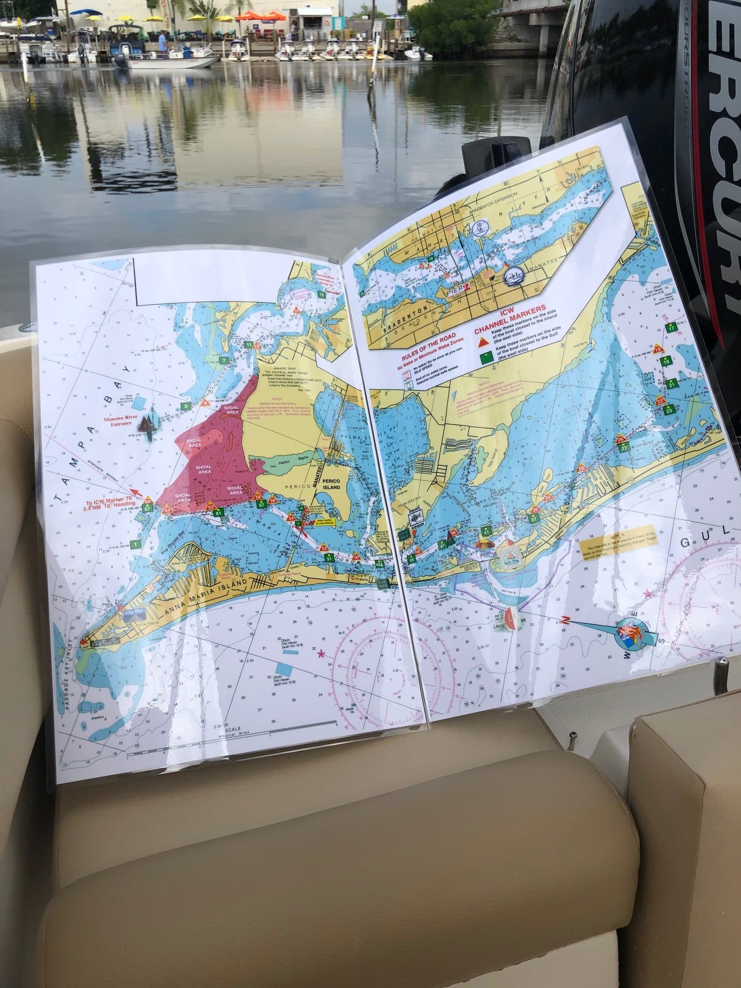
Tampa Bay to Sarasota New Pass Nautical Chart
$26.00
From the Sunshine Skyway Bridge west to Egmont Key and southwest to the ICW along Anna Maria Island and Longboat Key and Sarasota. Enlarged navigation markers along with photographic visuals. Each page of the chart measures 11″ x 17″. Full uv lamination at 10 mil. “Write-On Wipe-Off! Time after Time” with a Sharpie marker and alcohol. Used by Coast Guard and Coast Guard Auxilliaries, Marinas, Boat Rentals, Boat Club, County Sheriffs, Insurance Companies, Real Estate and more. Easiest Boating Chart You Will Ever Use

Manasquan to Barnegat, New Jersey Nautical Chart
$30.00
Showing Manasquan River and the NJ ICW south along the Point Pleasant Canal to the Metedeconk River, Tom’s River and Barnegat Bay. The Intracoastal Waterway has highlighted markers for easier navigation along with photographic visuals. The chart measures 11” x 17” closed and 22” x 17” open. Full uv lamination at 10 mil. “Write-On Wife-Off! Time after Time” with a Sharpie marker and alcohol. Used by Coast Guard and Coast Guard Auxilliaries, Marinas, Boat Rentals, Boat Clubs, County Sheriffs, Insurance companies, Real Estate and more! Easiest Boating Chart You Will Ever use.

Naples to Marco Island, Goodland and Cape Romano Nautical Charts
$26.00
Naples to Marco Island, Goodland and Cape Romano. Caution areas are highlighted and also key no wake zones and local restaurants. Enlarged navigation markers along with photographic visuals. The chart measures 11” x 17” closed and 22” x 17” open. Full uv lamination at 10 mil. “Write-On Wipe-Off with a Sharpie marker and alcohol. Used by Coast Guard and Coast Guard Auxiliaries, Marinas, Boat Rentals, Boat Clubs, County Sheriffs, Insurance companies, Real Estate and more! Easiest Boating Chart You Will Ever Use.

Grand Haven Michigan, Spring Lake and Lower Grand River Nautical Chart
$26.00
This chart covers the area of Grand Haven River, Spring Lake and Lower Grand River. Highlights include enlarged markers, local area restaurants and points of interest along with photographic visuals. The chart measures 11” x 17” closed and 22” x 17” open. Full uv lamination at 10 mil. “Write-On Wipe-Off! Time after Time” with a Sharpie marker and alcohol. Used by the Coast Guard and Coast Guard Auxilliaries, Marinas, Boat Rentals, Boat Clubs, County Sheriffs, Insurance companies, Real Estate and more! Easiest Boating Chart You Will Ever Use.
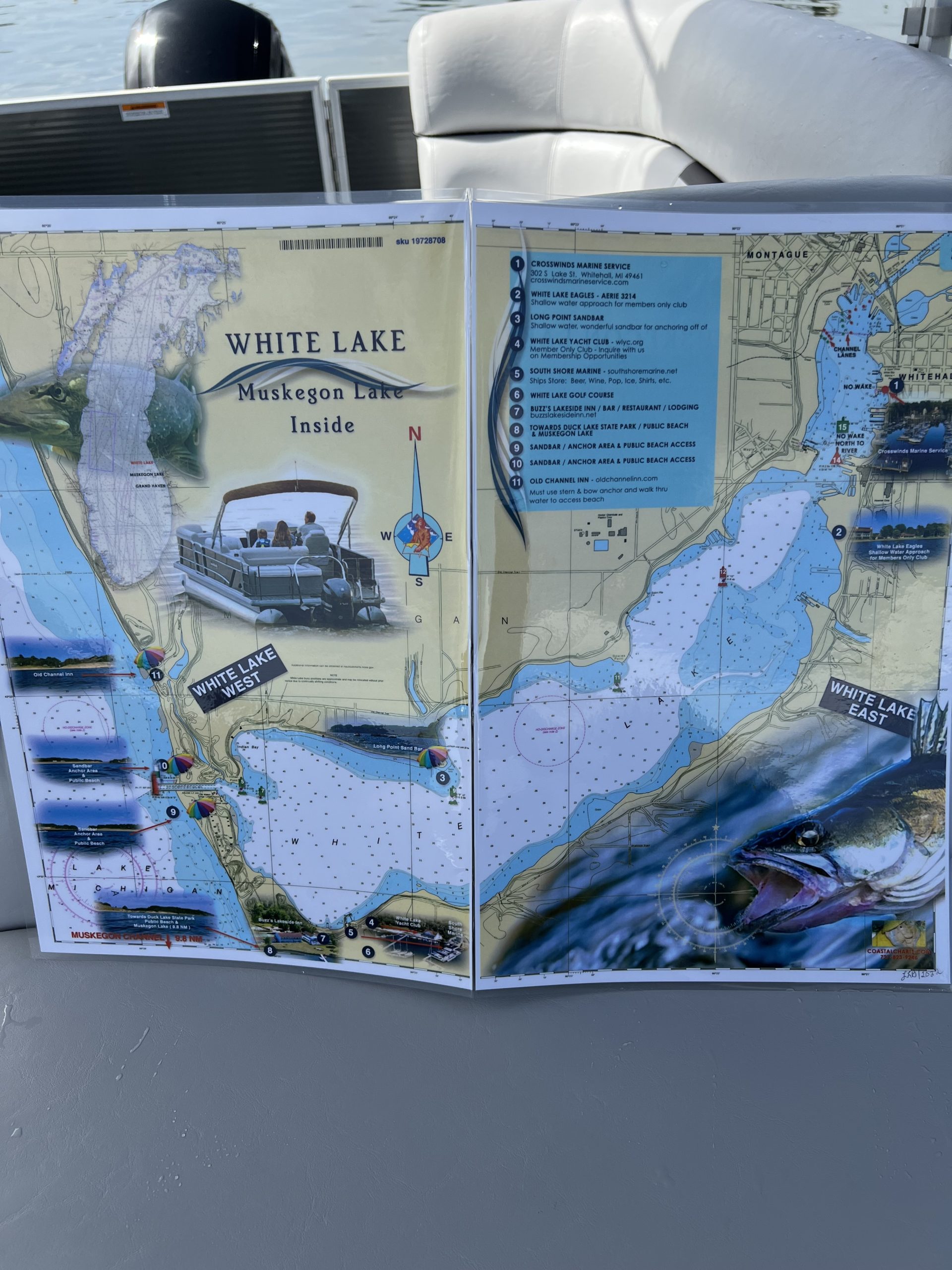
White Lake Michigan and Muskegon Lake Michigan Nautical Chart
$26.00
This chart covers the area of White Lake on the outside and Muskegon Lake on the inside. Highlights include enlarged markers, local area restaurants and points of interest and beach access along with photographic visuals. The chart measures 11” x 17” closed and 22” x 17” open. Full uv lamination at 10 mil. “Write-On Wipe-Off! Time after Time” with a Sharpie marker and alcohol. Used by the Coast Guard and Coast Guard Auxilliaries, Marinas, Boat Rentals, Boat Clubs, County Sheriffs, Insurance companies, Real Estate and more! Easiest Boating Chart You Will Ever Use.
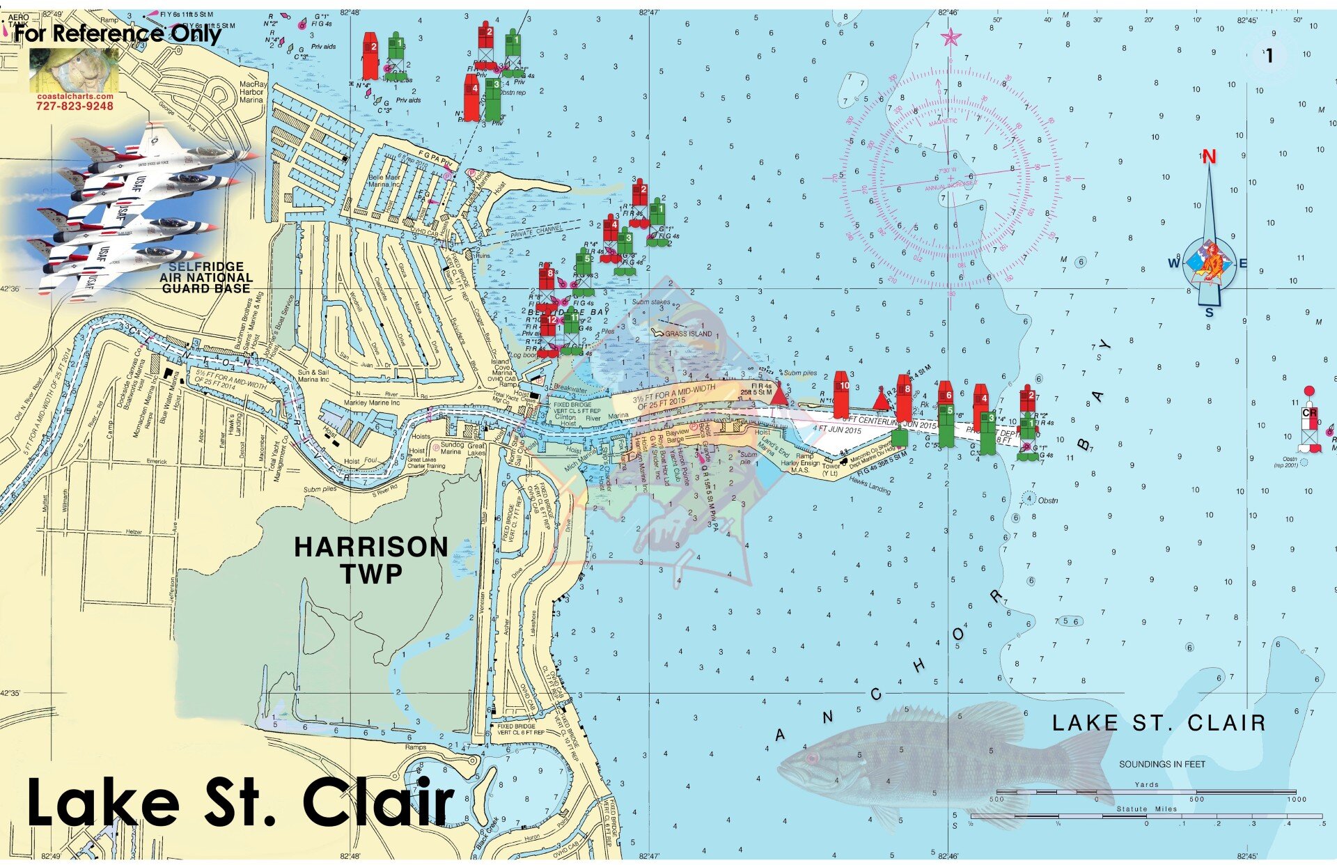
Lake St Clair
$26.00
Lake St. Clair is located between Michigan and Ontario, Canada. The first page includes an overview of Harrison township moving onward to cover Lake St. Clair and Lake Huron. From Port Huron and the St. Clair River down through Detroit, you’ll find easy-to-read detail for fishing hotspots, boating routes, and local points of interest. Waterfront restaurants and marinas are clearly marked. The chart measures 17″ x 11″ closed and 34″ x 11″ open. Full UV lamination at 10 mil. “Write-On Wipe-Off! Time after Time” with a Sharpie marker and alcohol. Used by Coast Guard and coast Guard Auxiliaries, Marinas, Boat Rentals, Boat Clubs, County Sheriffs, Insurance companies, Real Estate and more! Easiest Boating Chart You Will Ever Use
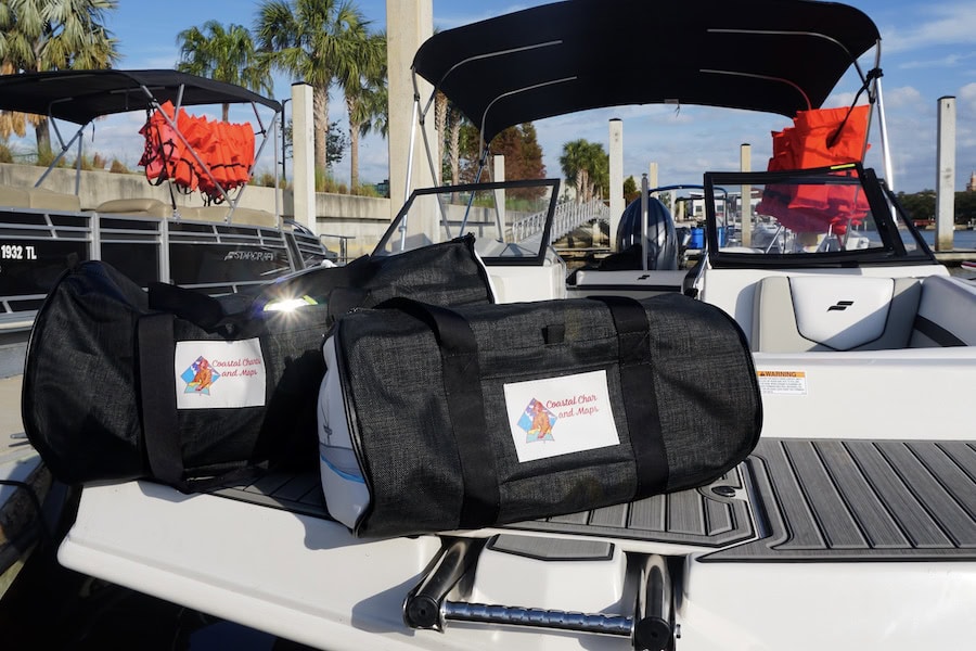
Captains Bags
$120.00
Durable mesh construction Front velcro pocket Heavy-Duty straps Customizable side panels Spacious interior Lightweight design, with versatile use